Author: Kenton Glick, used by permission
Photos: Jed Hess, used by permission
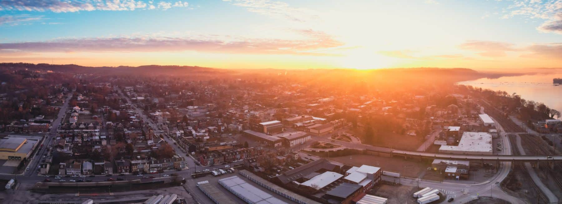
Did you know that in the 1700s and 1800s, Columbia was one of the most strategically important inland transportation hubs in Pennsylvania, and an up-and coming manufacturing center?
Vital roads, river traffic, canal systems and railroads all converged in Columbia. So we are not just talking locally important—Columbia was a crucial transportation node at the state-wide development level. This was no small-town stop. It was a major transfer location between the canal system, the roads, and railroads—a logistical crossroads.
Its strategic importance was recognized all the way back in the days of the Native Americans. The main east-west Native path at the time was the Great Minquas Path, beginning around Philadelphia, moving through what became Lancaster county, and terminating somewhere around Wrightsville.
It’s all because of the river-bend.
Early Years of Discovery
The Piedmont Ridge gets cut in two by the mighty Susquehanna River at this point. So regional north-south and east-west Indian paths would naturally converge here to avoid having to travel over the mountain range. It was the perfect place for Native peoples using the “river highway” to unload their canoes and fan out across the network of trails.
Settlers naturally followed the Native paths as they moved westward. And at Wright’s Ferry, both the natural blocks of the Piedmont and the Susquehanna were bridged when in 1726 Quaker John Wright settled along the Susquehanna. This was even a few years before the town of Lancaster was founded.
He built relationships and started making money in the fur trade. A village began to form, and Wright observed that the pressure to settle westward across the river was enough that he began operating Wright’s ferry in 1730 across the mile-wide Susquehanna. Soon he built a tavern to accommodate the travelers.
The first ferry was a primitive affair, consisting of two dugout canoes lashed together, fastened by wheels, and pulled by cattle. The ferries improved over the years until they could handle the multi-ton Conestoga Wagons. As traffic exploded, at one point there would be over a hundred wagons and travelers waiting for days to cross. But when Anderson’s ferry opened up in what is now Marietta, they had to drop their prices to compete.
In 1734 his son, John Jr., moved across the river and established another ferry and tavern to accommodate travelers who wished to travel east across the Susquehanna. As they grew into small towns they became known as Wrightsville East and Wrightsville West.
The river did not divide Lancaster County’s three River Towns—it connected them.
It was John Wright who petitioned the government to create Lancaster county. He had become a rich and important enough figure that he was even the one who named the county—after his home county of Lancashire.
Clearly Wrightsville was fast developing into an important regional hub.

Almost The Capital
Grandson Samuel Wright further developed the town structure in 1788. A plan was hatched to have the city become the capital of the new nation—which is why Samuel renamed it Columbia in honor of Christopher Columbus as a further enticement. George Washington was interested enough to accept it as a candidate—though ultimately it was not chosen. Vice President John Adams cast the tie breaking vote against the river town.
Yet even being on the “short list” to be considered as the nation’s capital shows how much it was esteemed back in the day.
In any case, the Columbia-Wrightsville area quickly became a vitally important link that paved the way for the development of York County, the western part of the state, and the Great Wagon Road that developed the frontier down into Virginia and the Carolinas. Columbia was a “gateway town” to the frontier.
In the mid to late 1700s, Philadelphia was the richest and most powerful city in the colonies. Lancaster was one of the most developed and important interior towns in all the British colonies. And Columbia was one of the most developed and important frontier towns in the state.
Links and Bridges
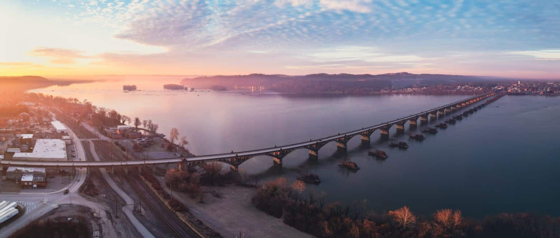
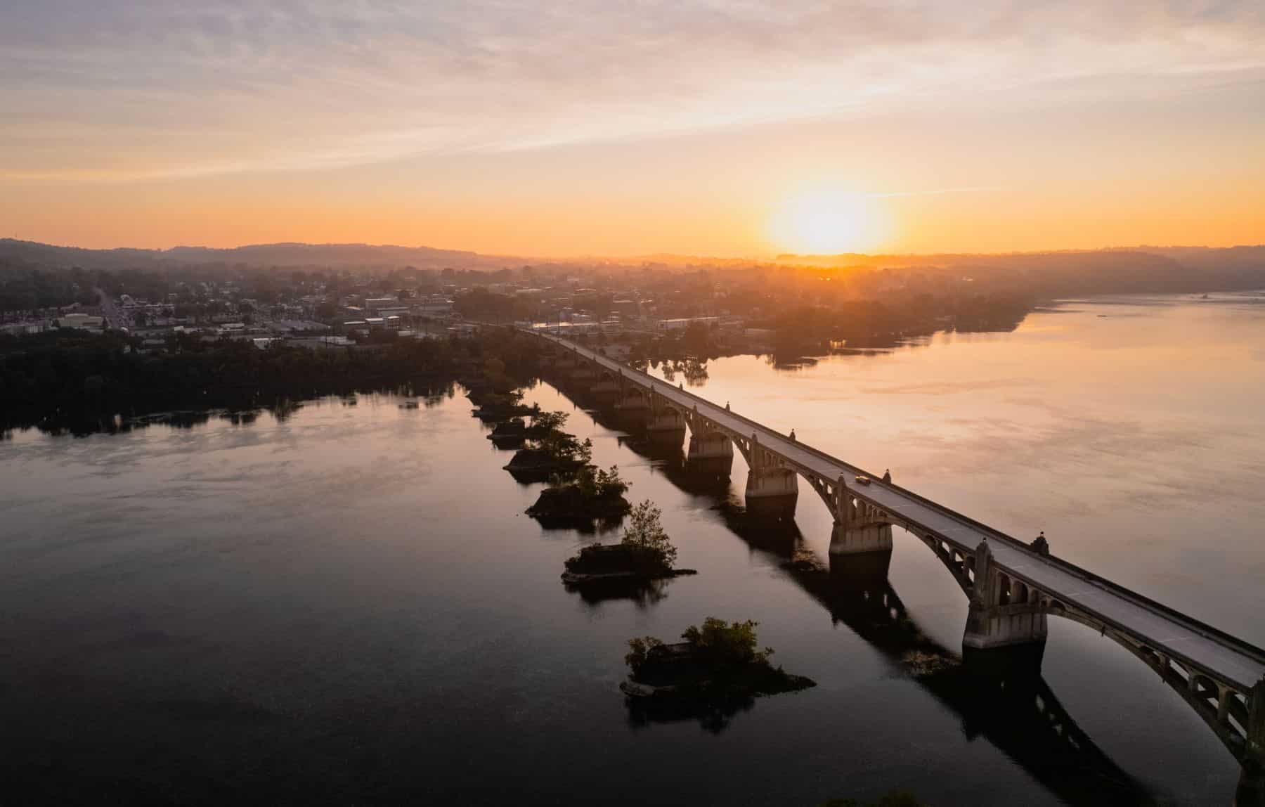
The Philadelphia-Lancaster-Columbia corridor was one of the most important corridors in the colonies back in the day. In 1814 the first of the Columbia-Wrightsville bridges was built. At about a mile, it was the longest covered bridge in the world, and was a large factor in speeding up development of the Pennsylvania frontier and beyond.
The 1820s and 1830s saw the Pennsylvania Canal system built, linking Pittsburg to Philadelphia. Columbia was an important transfer point—so important that in 1834 one of the earliest and most advanced railroads in the nation was built linking Philadelphia to Lancaster and on to Columbia.
Columbia-Wrightsville became one of the most important distribution nodes in the state. Lumber from Williamsport—the largest logging operation in the country at that time—floated down the Susquehanna in rafts. Some were diverted and processed in Columbian sawmills that sprang up. An extensive system of river warehouses were built to store the goods that converged for distribution.
Where you have railroads, you have industrial development. Iron works, rolling mills, lumber yards, and planing mills developed along Columbia’s riverfront and rail lines. Iron and manufactured goods moved outward by rail. This reshaped Columbia into a a working-class industrial town. By the mid to late 1800s, Columbia was a manufacturing and logistics center tied into a much larger regional economy.
This infrastructure was why Al Capone used Columbia as a major distribution point for his liquor-running operations in the Prohibition era of the 1920s. It’s why the first trans-continental road passed through Columbia. Few people remember today that before Rt 66, the Lincoln Highway was the nation’s longest highway.

As the nation developed westward, those connection dynamics changed. The transportation hubs that had once converged on Columbia diverged to other places. The economic opportunities moved elsewhere. Columbia fell on hard times.
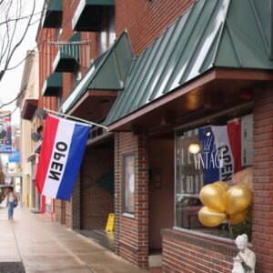
Yet Columbia is rising again today. Investment is returning. Businesses are opening.
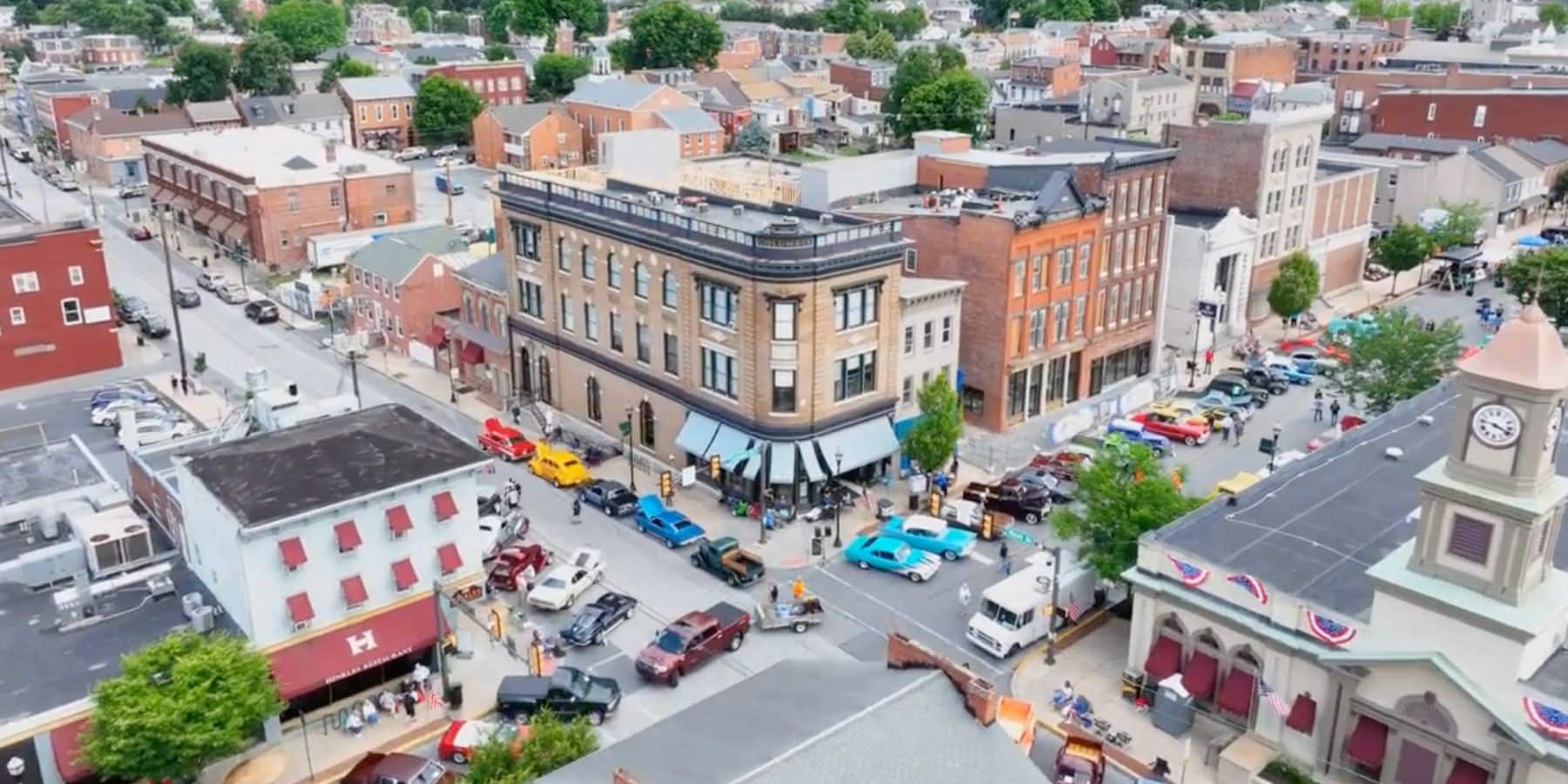
A Revived River Town
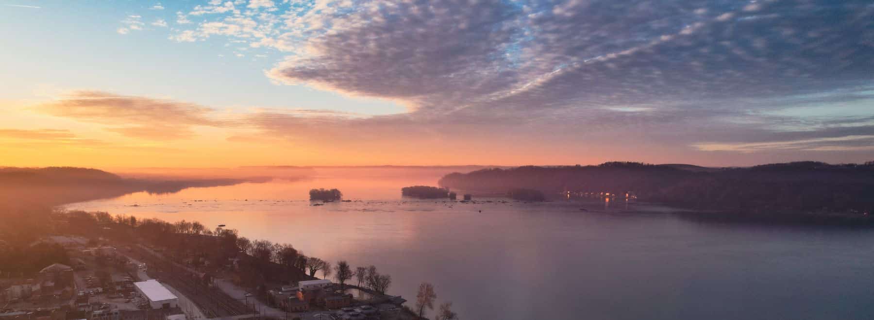
Today, when one drives out to the Breezyview point looking over the river—or hikes out to Chickies Rock—you get a bird’s eye view of the river bending its silver curves to carve through the Allegheny Mountains and flow past the River Towns.
When you step into that space, you are also stepping into the rhythm of a bygone era: a time when the whistles of factories and steam locomotives—and the clang of ironworks and sawmills—filled the air. Maybe you can even see a ferry crossing out from Marietta, one loaded with a Conestoga wagon coming out of Wrightsville East, and passing another ferry out of Wrightsville West.
Pulled by cattle with men fighting against the currents threatening to sweep them away.
The memories—the ebb and flow of the mighty currents of the industrializing town and the earlier, slower times from the frontier days—also remain. And they continue to shape our lives and shared destinies.